
Northampton County Neighbors by Block
Public records around a Northampton County address answer narrow questions. GIS supplies parcel outlines and their relationship to adjoining tax parcels. Assessment Data supplies the tax-record owner, mailing address, and situs distinction for a known parcel. The Recorder can add a dated ownership trail once the legal description is checked. Historical cross-reference directories and maps add earlier address context. A named voter-status tool confirms one registration and does not create a nearby-address directory.
| Source | Block evidence | Access |
|---|---|---|
| County GIS | Parcel outlines, boundaries, and relation to adjoining tax parcels. | County GIS interactive-map route. |
| Assessment Data | Tax-record owner, mailing address, situs, and parcel identifiers for an identified parcel. | NCPUB public application. |
| Recorder | Recorded ownership history and legal-description trail for each parcel. | Recorder of Deeds and Landex route. |
| Cross-reference directories | Historical listed address pattern for a covered place and year. | Marx Room, with year and coverage limits. |
| Historic maps | Period land, building, street, or householder context. | Library and archival map collections. |
| Voter resources | A named person’s official registration confirmation where allowed. | State and county election route, not a block browse. |
Owner and mailing fields are not a complete account of who is on a block. The county itself distinguishes the situs from the mailing address, and a parcel may be held by an estate, trust, organization, or more than one party. Note: Treat every field as a lead that needs the right custodian and a dated source record.
Northampton County Buffer Search
The county’s Buffer Search makes a parcel-defined area more precise than a broad street-name search. It accepts a CAMA ID, location, or owner last name. Select the starting parcel with a map click or drawing tool, then enable a search distance. The displayed default is 300 feet, and the distance can be set in feet, yards, meters, kilometers, or miles. Point, line, polyline, polygon, and freehand-polygon tools let the search follow a short block shape rather than a whole road.
The Buffer Search export identifies Parcel ID, Parcel Location, Occupant, and Mailing Address. Those are tax-map output labels. They do not certify a current household list. Save the starting parcel and distance used, then check the returned parcel IDs one by one in Assessment Data and, where needed, the Recorder. A narrow selection is better for Northampton County neighbors than an oversized radius that crosses unrelated streets or municipal lines.
Northampton County Parcel Map Results
The County parcels ArcGIS data-service field inventory shows why a parcel ID is the useful bridge. Its published fields include parcel and CAMA IDs, map/block/lot, municipality, location, owner lines, mailing-address lines, values, deed reference, and geometry. It may also display tax-program flags and building attributes. A deed reference is a lead for Recorder research, not the deed image or a title guarantee.
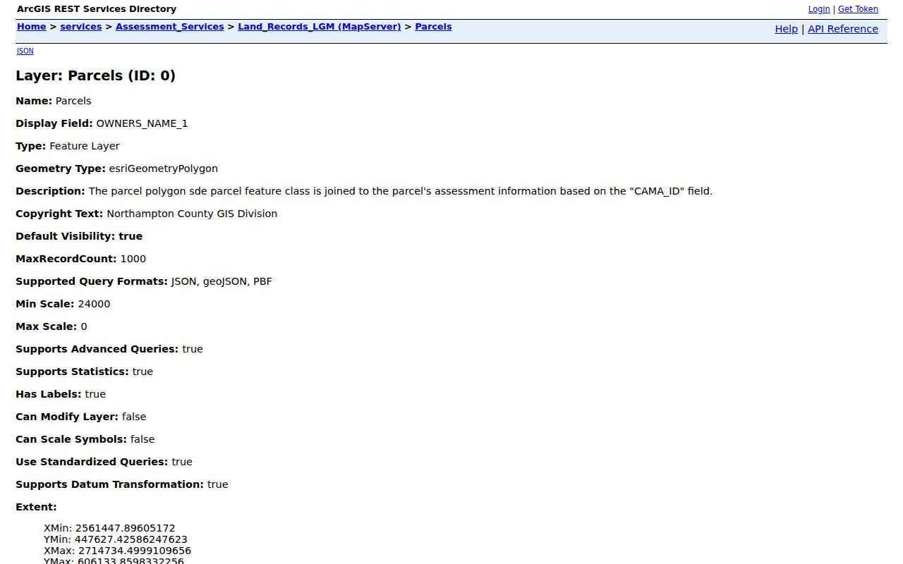
Use the service fields to distinguish map location, mailing data, and the recorded-document reference before making any comparison. A tax-program flag or an occupant-style label cannot establish the people currently at a parcel. The parcel’s legal description and a dated Recorder record remain the stronger path for an ownership question.
Map Northampton County Neighbors
The adjacent-parcel method is repeatable. First locate the target address in Assessment Data or the GIS viewer and record its situs, municipality, and parcel number. Zoom to the shared boundaries, identify an adjoining parcel, and record that parcel number rather than a name guessed from the map position. Carry each number into Assessment Data, where the tax-record owner and mailing fields can be read in their proper context.
- Find the target location using the county address or parcel route, then preserve the parcel ID and municipality.
- Use the interactive map or Buffer Search to select only adjoining or deliberately nearby parcels.
- Record each returned parcel ID, location, and map relationship before checking any owner field.
- Review each parcel in Assessment Data and keep the situs separate from a mailing address or any other label.
- For a transfer question, follow the parcel’s legal-description and deed reference into the Recorder trail.
For a complete named-street record chain, use the Northampton County Street Directory. The block method stays focused on adjacent parcels and a defined radius, rather than trying to turn a whole street into one undifferentiated list.
Northampton County Neighbor Sources Compared
Official county sources have identifiable fields, geographic boundaries, and a custodian who can explain a record. A commercial neighbor-tool category may combine records from different dates and sources, which can leave a person or parcel attached to the wrong address. The distinction matters most when a common name, changed street number, or mailing address enters the result.
| Official parcel and record route | Commercial neighbor-tool category |
|---|---|
| Starts with a parcel, GIS boundary, or recorded instrument tied to Northampton County. | May combine public and other data with different dates and matching methods. |
| Lets a researcher inspect a parcel ID, situs, map relationship, legal description, and recording date. | May show a simplified address association without the source document or date context. |
| Can be checked with the Assessment Office, Recorder, GIS staff, or other named custodian. | Needs independent verification before any factual reliance. |
The official route is still limited. It can establish a tax-record or recorded-document relationship, but not every person linked to a place. That limit is more useful than a polished result that hides how its data was assembled.
Northampton County Voter List Limits
Pennsylvania’s personal voter-status lookup is designed to confirm a specific registration. It is not a tool for browsing a nearby-address list. State voter-list procedures describe separate products, including a street list, but they also impose requester, distribution, and use limits. The request form says lists may not be published on the internet and restricts their use to election, political, or law-enforcement purposes.
Protected-address and Address Confidentiality Program rules still apply. Sensitive identifiers, signatures, and other protected voter fields are not public-list material. A nonmatch is also not proof that a person was never in Northampton County, because a record can reflect a move, a changed status, a name variation, an error, or a protected address. Direct voter questions to the Northampton County Elections Division or the official state process.
Northampton County Historic Block Context
The Marx Room newspaper index for historic block context helps bridge the time between a directory, deed, or map. Marx Room holdings include Easton city and cross-reference directories, maps, and microfilmed newspapers beginning in 1799. Its article index spans 1799 to 1899, 1900 to 1920, 1921 to 1961, 1962 to 1972, 1973 to 1996, and 2005 to 2007. The indexed item is a path to the underlying issue, where the exact date, title, page, and context can be checked.
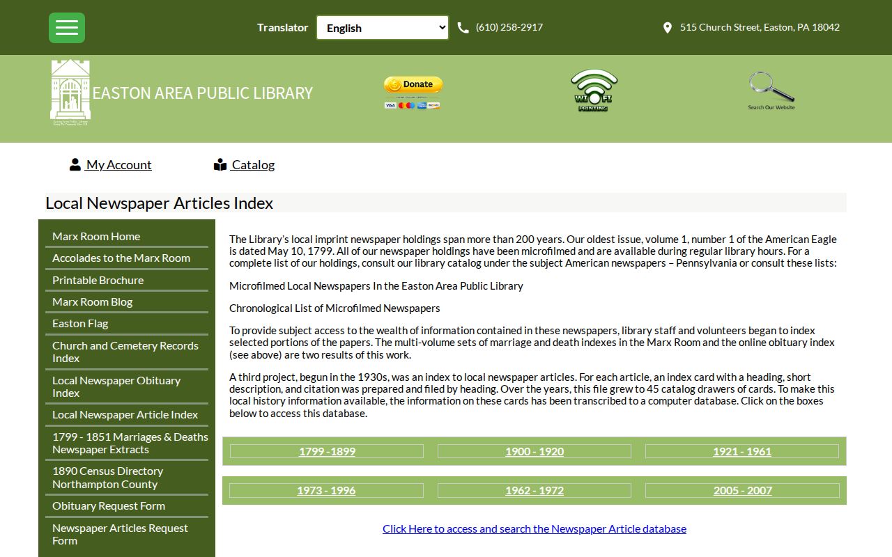
The image belongs to the historic-source route, not a modern neighbor list. A cross-reference directory may show a printed address entry for a covered year. The 1860 county map may label property owners or householders in village insets, while Sanborn sheets describe building and land-use context. Keep the map or directory date beside the finding and do not carry it forward as a current claim.
Northampton County Community Records
No official countywide neighborhood-association inventory or membership directory was located. That absence matters. Northampton County has many municipalities, and civic or association information is local to the municipality identified by the parcel, if it is published at all. It would be inaccurate to present a countywide roster of associations or members.
| Confirmed local resource | Useful block context | What it does not provide |
|---|---|---|
| Northampton County Historical and Genealogical Society / Sigal Museum | County history and research-contact route. | A neighborhood membership directory. |
| Henry F. Marx Local History Room | Easton-oriented directories, maps, newspapers, and local-history material. | A current countywide association roster. |
| Bethlehem Room | Greater Bethlehem directories, municipal records, maps, and historical collections. | A parcel-by-parcel present-neighbor list. |
| Municipality identified by the parcel | Its official code, records, or civic contact route for a specific street. | Proof that every group has public membership information. |
For a locality-specific organization, first confirm the municipality from GIS and Assessment Data. Then consult that municipality’s official site or the organization’s official contact page. A historical institution can help explain a block, but it is not evidence of present membership.
Northampton County Neighbors and Privacy
Several kinds of block information remain private or restricted: household membership not recorded in property rolls, protected voter addresses, Address Confidentiality Program locations, motor-vehicle information, utility customer information, and nonpublic court, safety, or victim material. Pennsylvania’s Right-to-Know Law presumes records open only until an exception, another law, privilege, or court order applies. A county request is not a way to bypass those protections.
Lawful use. Northampton County neighbor research can support local history, civic curiosity, and a parcel-specific record question. Do not use an address or record trail to monitor, harass, intimidate, or harm anyone.
A substitute mailing address may appear legitimately in a public-facing record. Respect it. If an assessment, Recorder, or GIS field appears wrong, ask the custodian responsible for that field about its correction process rather than trying to reconstruct information from unrelated records.
Northampton County Block Record Limits
The NCPUB map and parcel-buffer search offers another map-first route. Its controls include freehand, point, box, polygon, and line selection, parcel-center or polygon buffer selection, a default 100-unit buffer, feet or meters options, selected-record reports, and map exports. The map service has a 1,000-parcel cap, so a small block selection is more reliable than a sweeping area request.
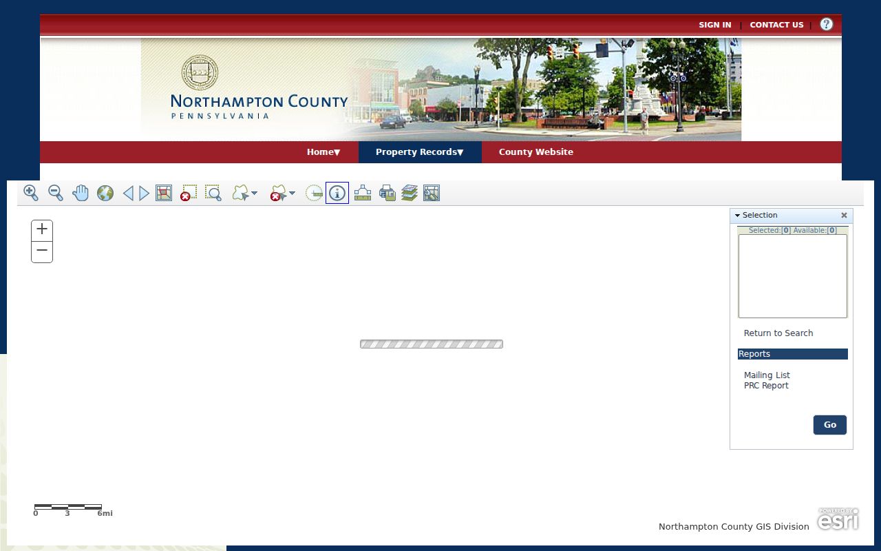
Use that map output to retain parcel IDs and geographic context, then confirm records parcel by parcel. It is not a directory of people. The strongest Northampton County neighbors result names the source, the parcel relationship, and the record date, while keeping the clear line between ownership, historical listing, and present household membership.